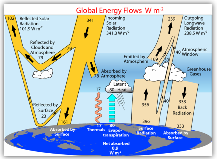
A quantitatively rigorous investigation of the, geological, biological, chemical, and physical, dynamics of the global oceans, including, implications of ocean policy. Topics include, geology of the seafloor, coastal erosion, waves,, tides, storm surge, sea-level rise, ocean, circulation, composition of seawater,, biogeochemical cycles, and ocean acidity., Compelling issues in oceanography, which may, include deep-ocean mining, coastal development,, tsunami hazards, ocean pollution, or others., Weekly laboratory includes two required daylong, field trips, held on weekends.
- Teacher: Jessica Kleiss
Introduction to major geological processes that, impact human activity. Emphasis on regional, issues. Plate tectonics, loci of seismic and, volcanic activity, distribution of mountain, ranges, and sediment sources. Floods, landslides,, mudflows, tsunamis. Assessment of anthropogenic, shifts in landscape functioning. Chronic vs., catastrophic environmentally significant events., Lecture and laboratory. Weekly laboratory includes, two required daylong field trips, held on, weekends.
- Teacher: Elizabeth Safran